What can we do?
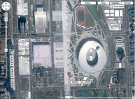
When you proudly show off the pictures from that great safari but just could not remember where they were taken?
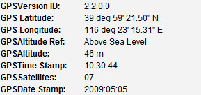
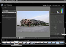
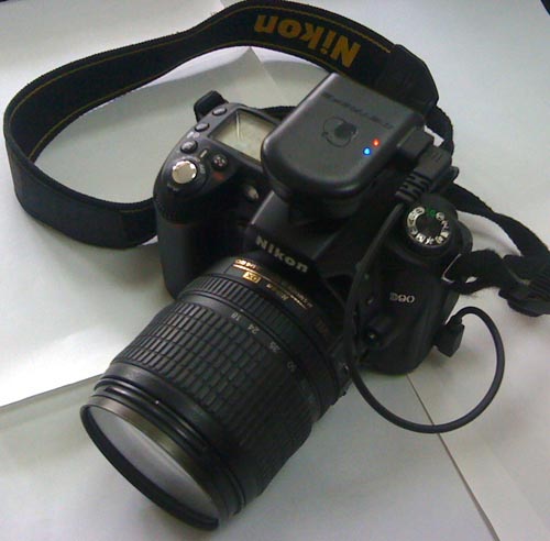
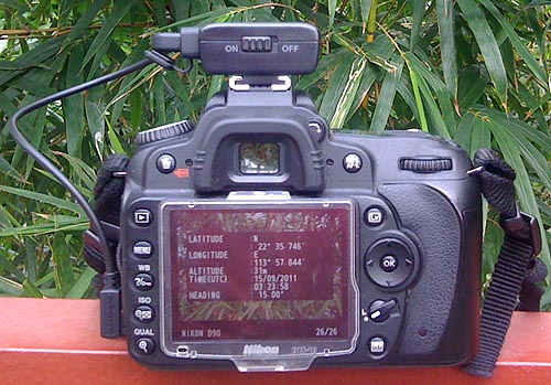
Well, you are not alone. Photographers faces the same problem for years. An elegant solution came when Nikon released its Nikon D200 camera. It supports writing the GPS coordinates directly into the digital pictures when you release the shutter. No post processing on a computer required. The subsequent cameras releases by Nikon, such as D300, D90, D5000, D5100, D7000, etc all support direct geotagging. Many of these cameras have a dedicated GPS connector. All you need is a small GPS receiver and connecting cables to the camera.
MetaGPS Inc. is founded in 2008 to provide easy to use geotagging solutions. After one year of development, testing and production, the MetaGPS M series products (M0, M1 and M2) for Nikon digital cameras were released in 2009.